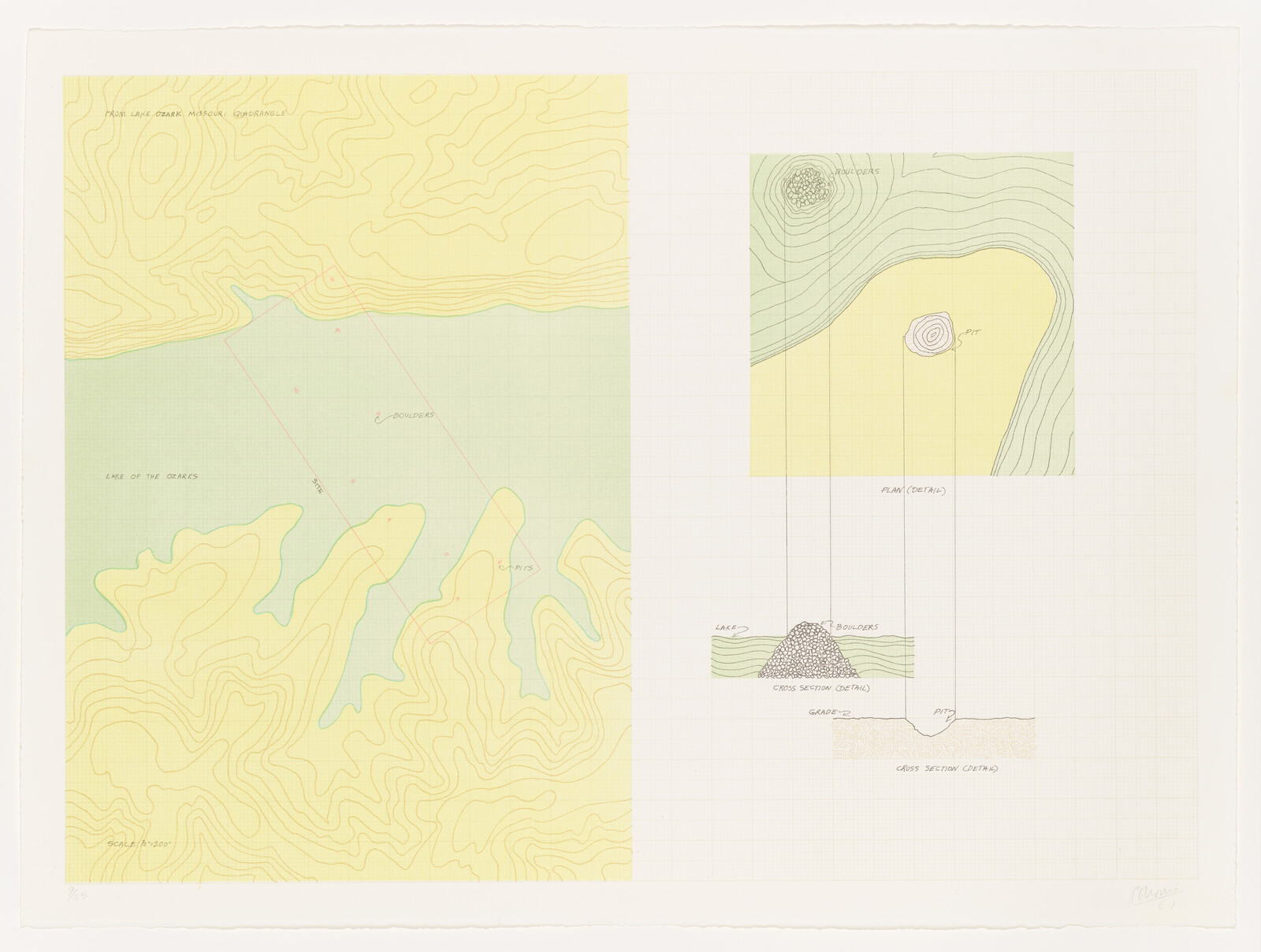
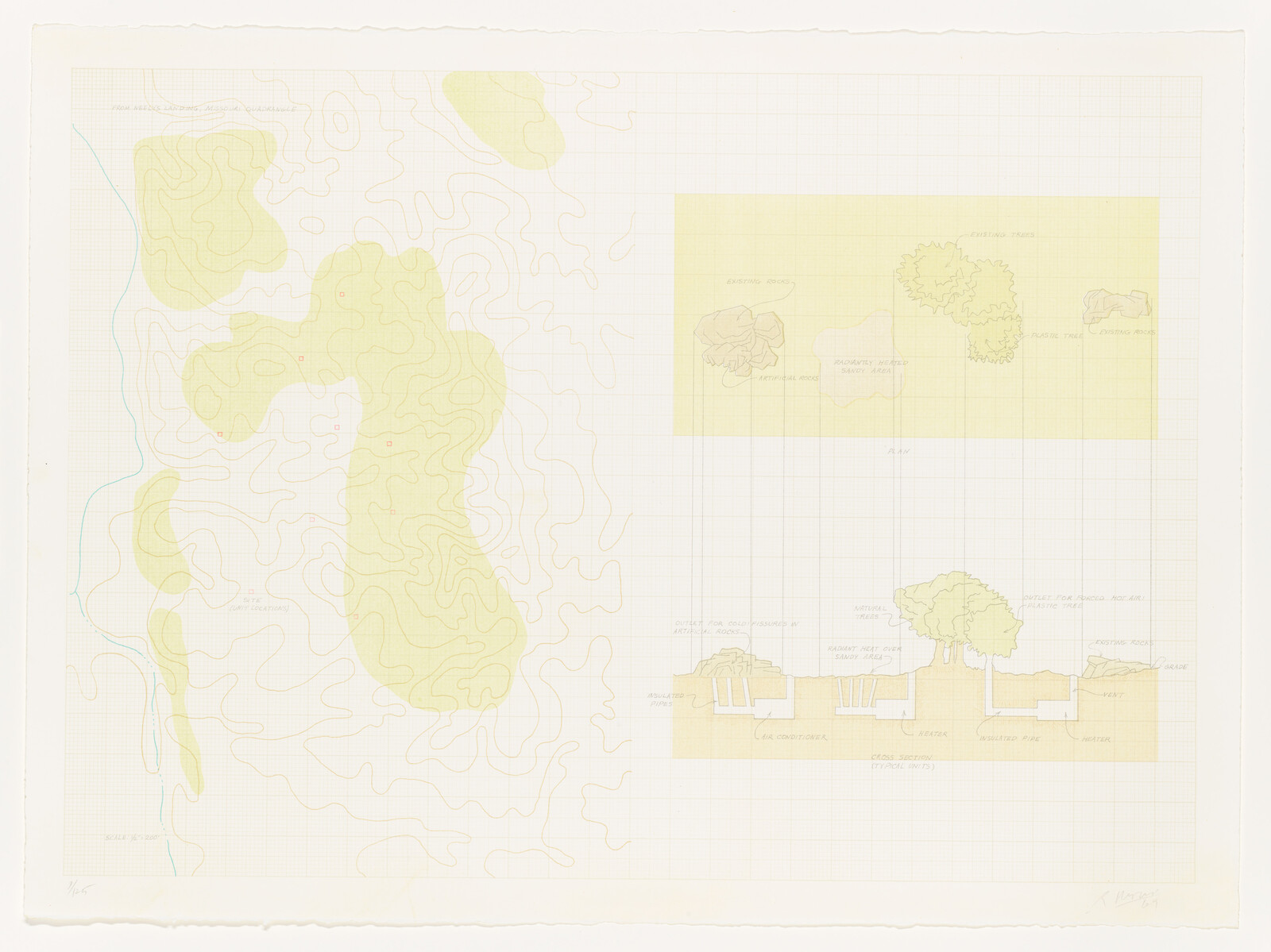
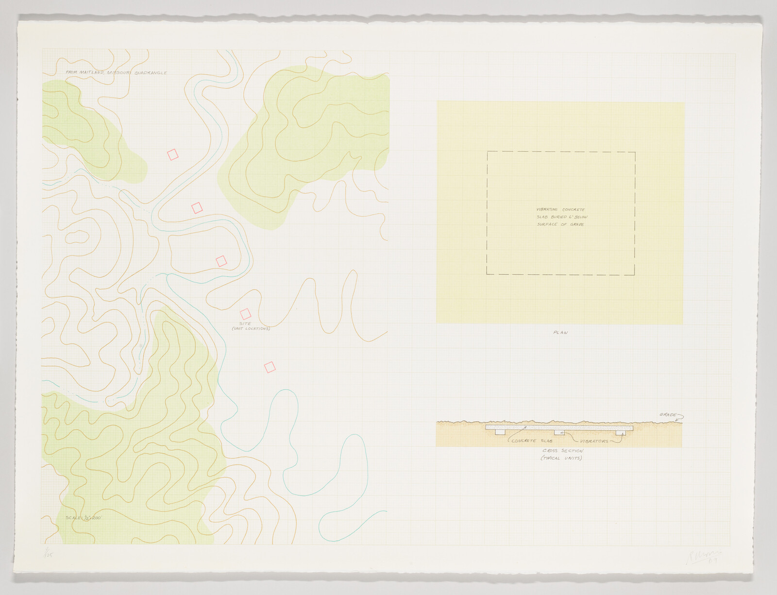
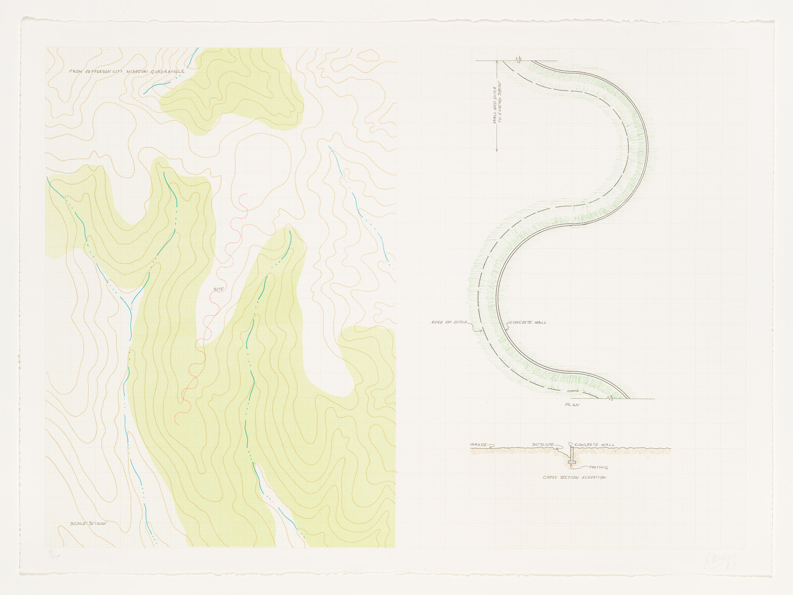
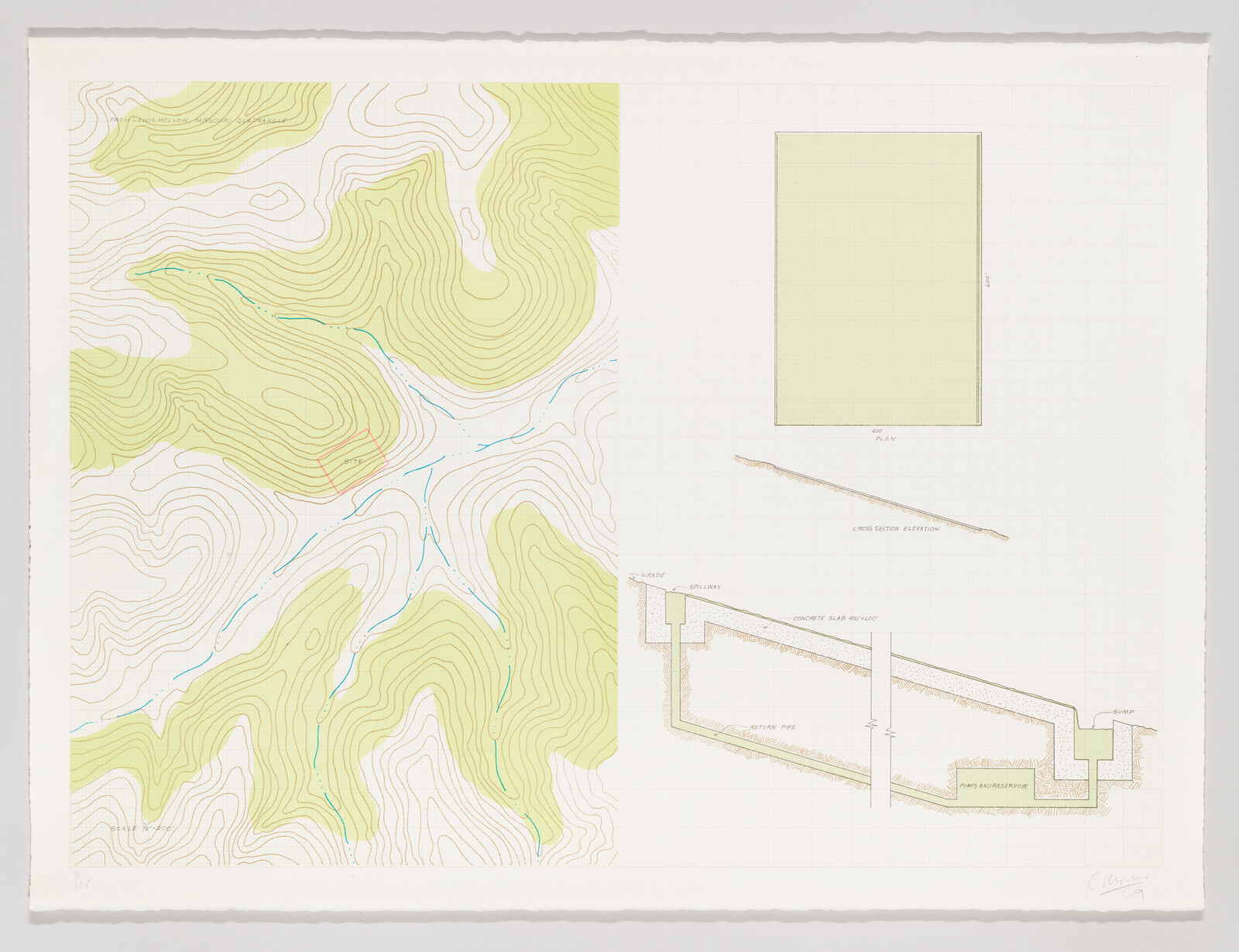
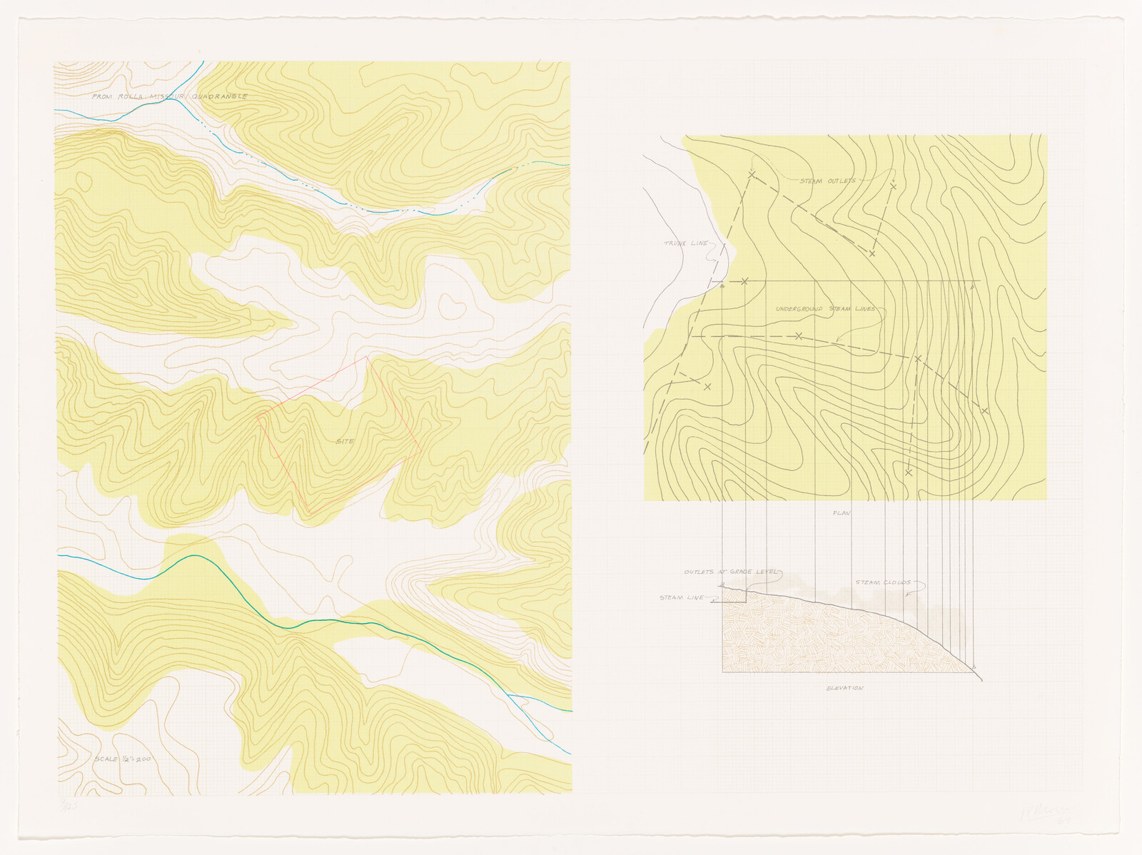
Robert Morris

Steam
1969

Not on view

Date
1969

Classification
Prints

Medium
Lithograph

Dimensions
Sheet (Irregular): 22 1/4 × 30in. (56.5 × 76.2 cm) Image: 20 × 27 15/16in. (50.8 × 71 cm)

Accession number
70.27.6

Edition
9/125 | Possibly 15 proofs

Publication
Printed by Aris Koutroulis; printed by Theo Wujcik; published by Friends of Modern Art of the Detroit Institute of Arts

Credit line
Whitney Museum of American Art, New York; purchase

Rights and reproductions
©Robert Morris/Artists Rights Society (ARS), New York
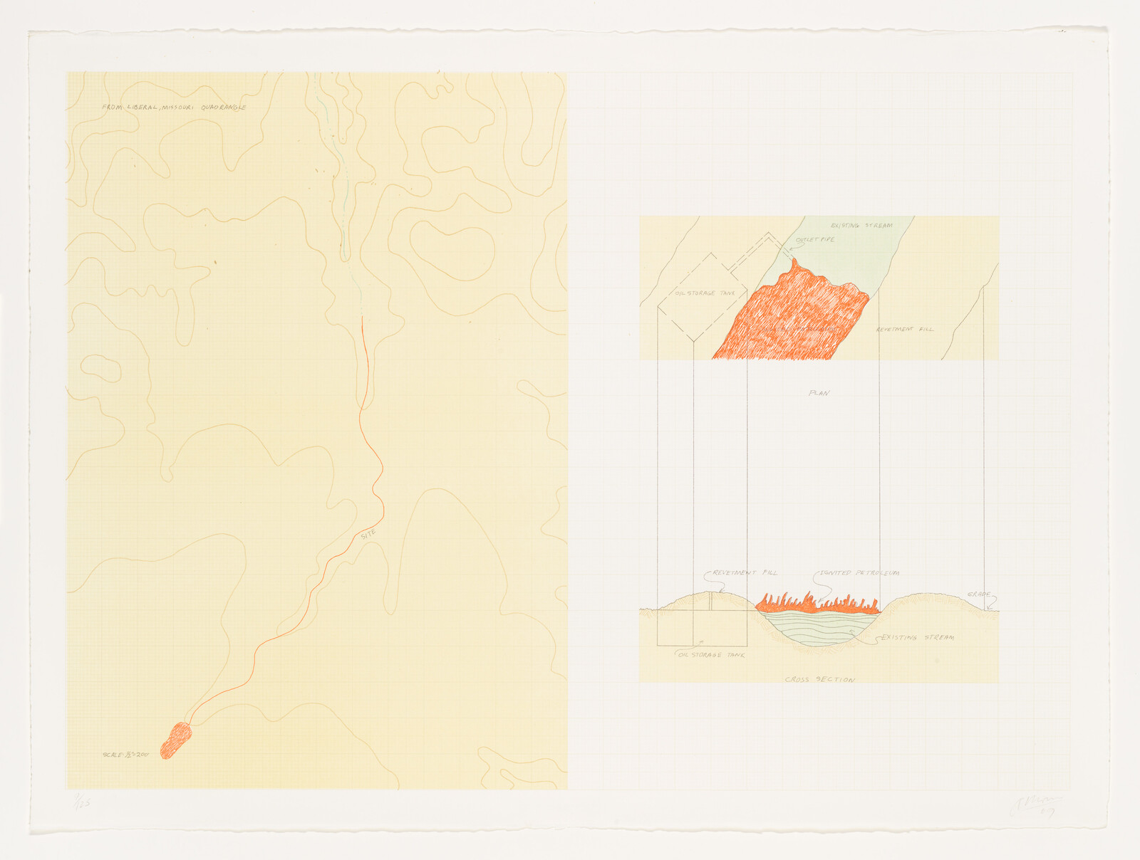
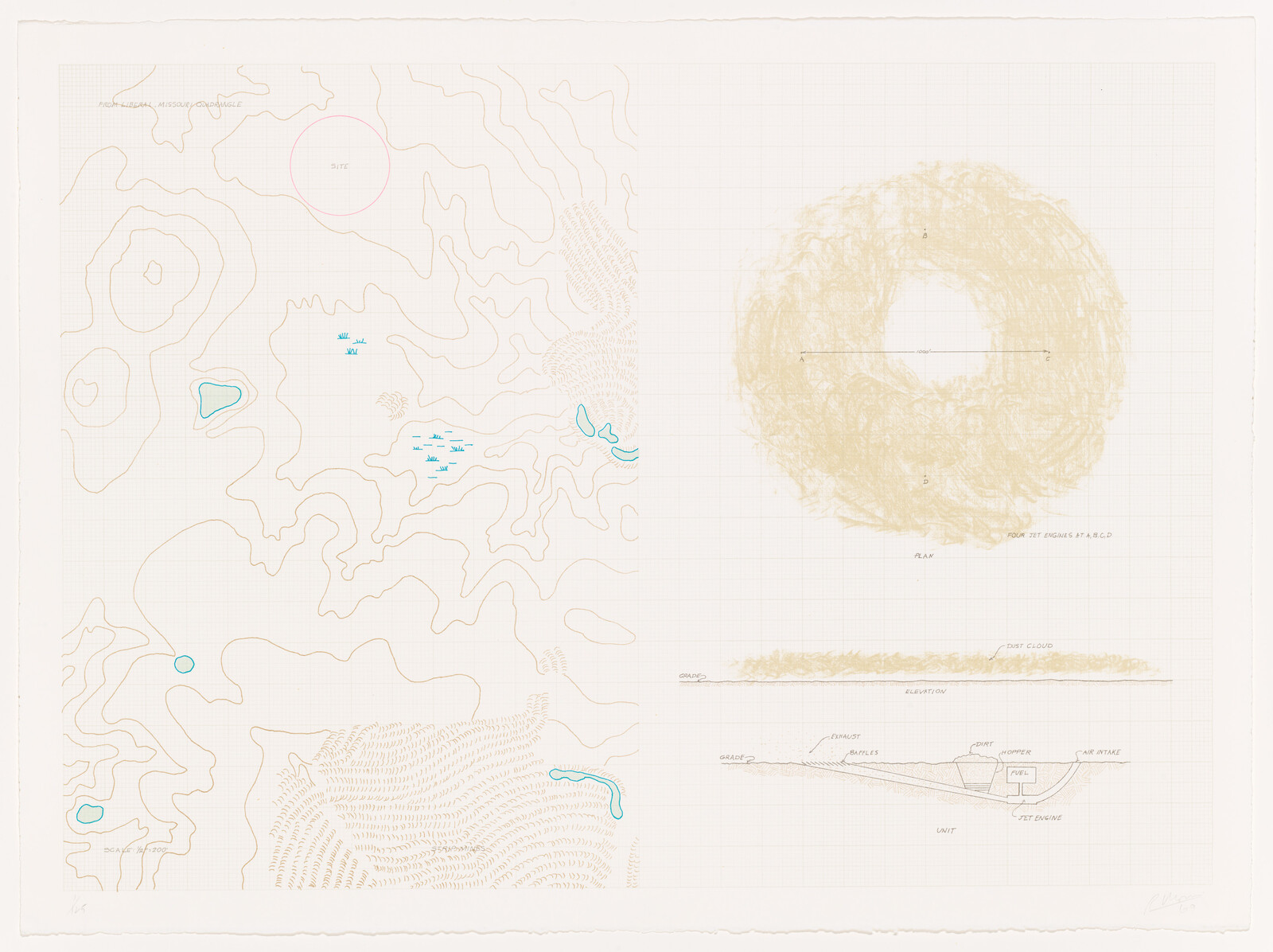
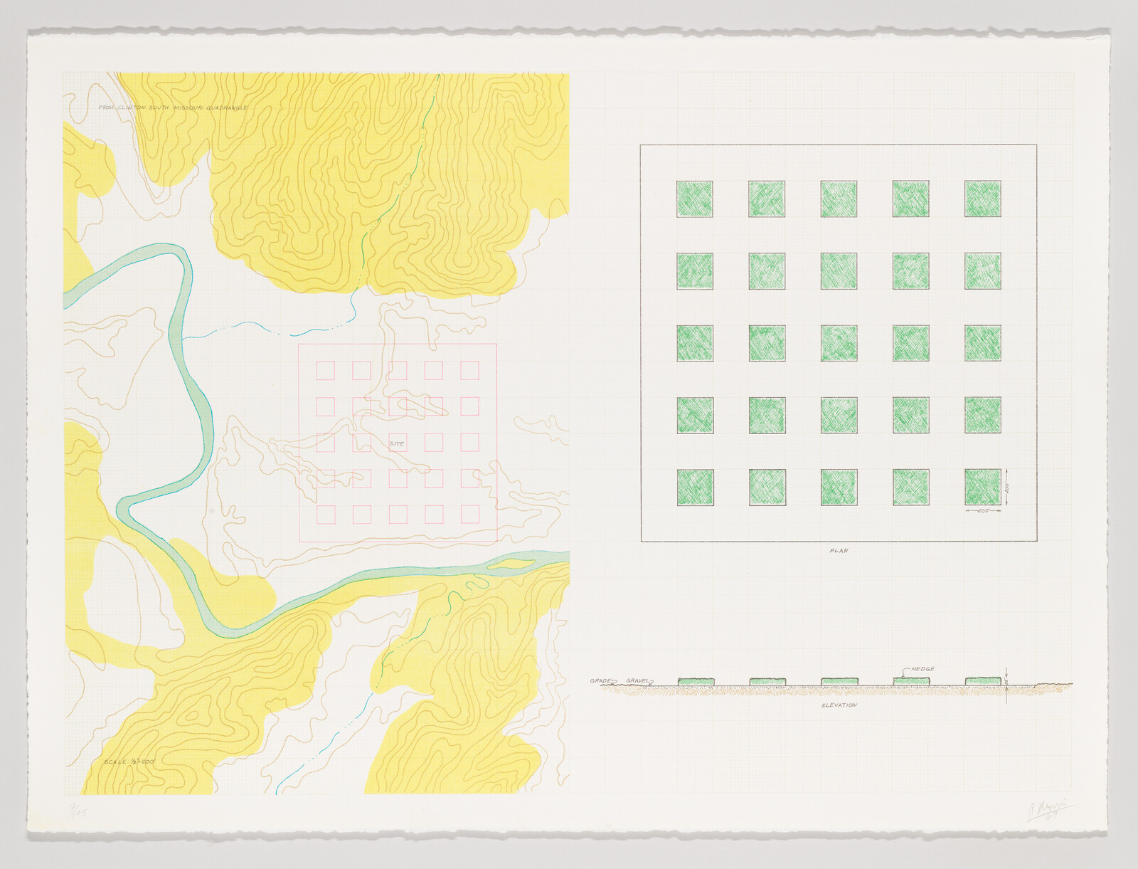
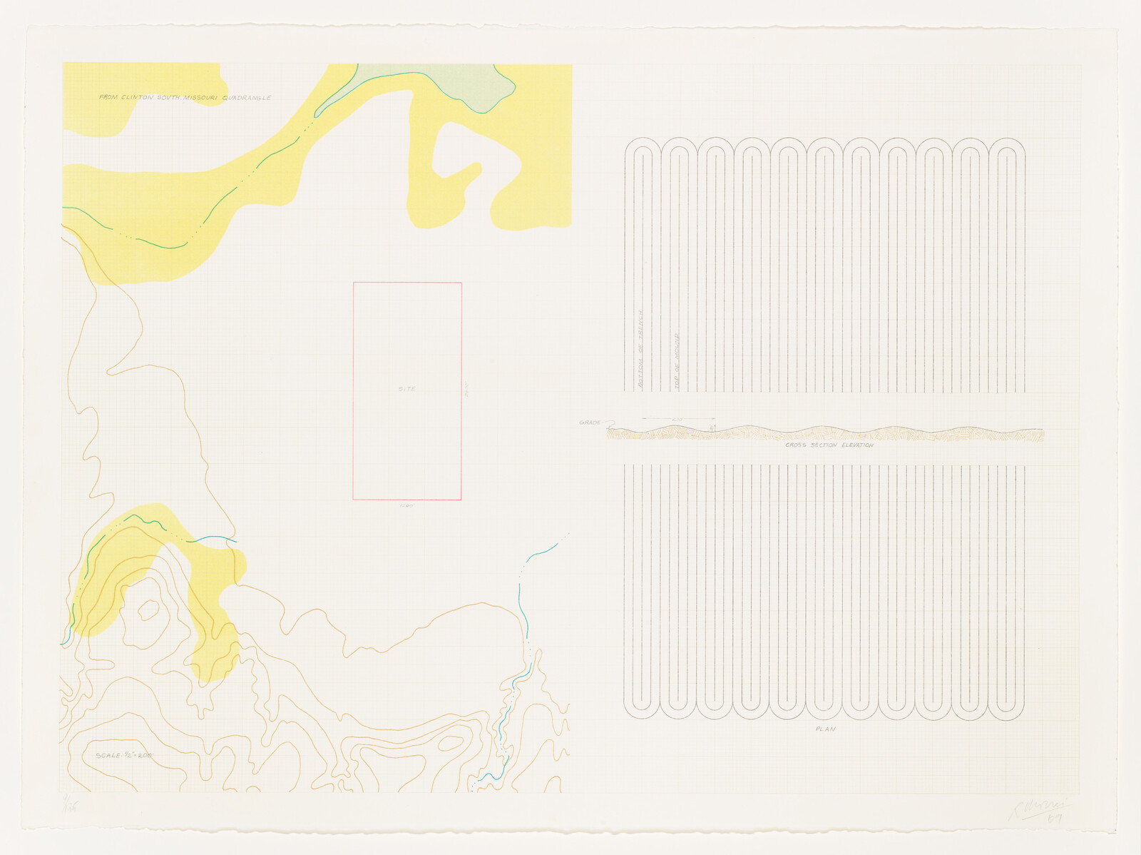
API
artworks/7235

Part of a series:

Earth Projects

10 works

This image displays a conceptual art piece consisting of a grid with two sections of topographic and geological illustrations. On the left, there is a topographic map with contour lines in beige and a red line indicating a path or feature. The right side shows a graph paper background with two drawings: the upper drawing is a plan view of a geological formation in orange, green, and beige, while the lower drawing is a cross-section of the same formation, showing layers and a labeled "existing stream." The artwork combines elements of scientific illustration with an abstract, minimalist aesthetic.
A conceptual art piece featuring various abstract representations, including topographic-like contour lines, a circular scribble pattern, and a cross-section diagram, all rendered in soft colors on a grid background.
A detailed artistic rendering of a map and architectural plan, featuring a topographic map with yellow and green contours on the left, and a grid of green squares representing a site plan on the right. Below the grid is a linear elevation drawing. The image has a white background and is marked with grid lines and annotations, suggesting a professional or technical design.
A detailed architectural drawing featuring various abstract elements, including contour lines and color blocks on the left, and a series of parallel lines with a wave-like pattern above and below in the center and right sections. The image contains text annotations such as "SCALE 1"=40'0"", "GRASS SECTION ELEVATION", and "PLAN", suggesting a technical design or plan. The bottom right corner is signed and dated '67. The background grid aids in the precise layout of the design elements.
A detailed topographic map with contour lines in shades of yellow and green, featuring labeled geographic features such as "Lake of the Crags" and "Mt. Moran." There are three inset diagrams at the bottom showing cross-sections of the terrain, with annotations for "Lake," "Boulders," "Gravel," and "Pit." The map has a grid overlay and is marked with red surveying lines. The artwork is signed and numbered at the bottom left.
A detailed topographic map with contour lines in yellow on a white background, featuring two separate sections with grid lines. The left section shows a larger area with a blue line representing a water feature, while the right section includes annotations such as "system outflow" and "underground stream launch," along with smaller inset diagrams labeled "plan," "elevation," and "details - sand ripples."
This image displays a conceptual landscape architecture drawing with topographic lines and color-coded areas. On the left, there are contour lines suggesting terrain elevation changes, shaded in green and yellow tones. On the right, there's a yellow grid with labeled design elements such as "existing trees," "proposed trees," and "ground cover." Below the grid, there are architectural sketches of tree and shrub plantings with labels indicating the types of plants and materials used. The drawing has a technical and artistic quality, combining precise mapping with creative design elements.
Artistic representation of a topographic map with contour lines and abstract elements, including text boxes with dashed outlines.
A detailed topographic map with contour lines in shades of green and yellow, featuring a winding structure resembling a road or path with cross-sectional diagrams on the right side, indicating a concrete wall and footing. The map is overlaid on a grid background, suggesting a technical or architectural drawing.
A detailed topographic map occupies the left side of the image, with contour lines in shades of green and brown indicating elevation changes. To the right, there are three separate technical drawings: a green-tinted plan view at the top, a long horizontal cross-section view in the middle, and a detailed cross-section of a structure with annotations at the bottom. The image has a white background and is marked by the artist's signature in the lower right corner.