
Re-Mapping
“Landscape is always full of movement.”
–Jaune Quick-to-See Smith
Jaune Quick-to-See Smith often begins her art “with a very general idea, like maps.” She likes “to use maps because maps can tell stories.” The artist’s decades-long interest in maps began in response to the 1992 fifth centennial of Christopher Columbus’s arrival in the Americas. In Indian Map, Smith combines a painted United States map with collaged fragments of newspaper headlines, comic strips, and images and articles regarding Native Americans. Ironic phrases like “Fusion Illusion?,” “Building on Lessons of Past,” “Indian Country,” “Pilgrim's Progress,” and “Want a steal?” highlight past atrocities against Native Americans and ongoing land injustices and environmental issues. The dripping paint blurs state boundaries, and calls attention to reservation policies. This concept of borders did not exist in Indigenous ideology. Smith explains, “Because of popular myth-making, Native Americans are seen as vanished. It helps assuage the government’s guilt about an undocumented genocide, as well as stealing the whole country.” In State Names Map I, she “only named half of the states, the ones that carry Native American names, and left out all the states with European names.” For Smith, “A map is not an empty form…it’s not an icon of this incredible country. It’s not just a vacant idea, it’s real. It’s about real land—stolen land, polluted land.”
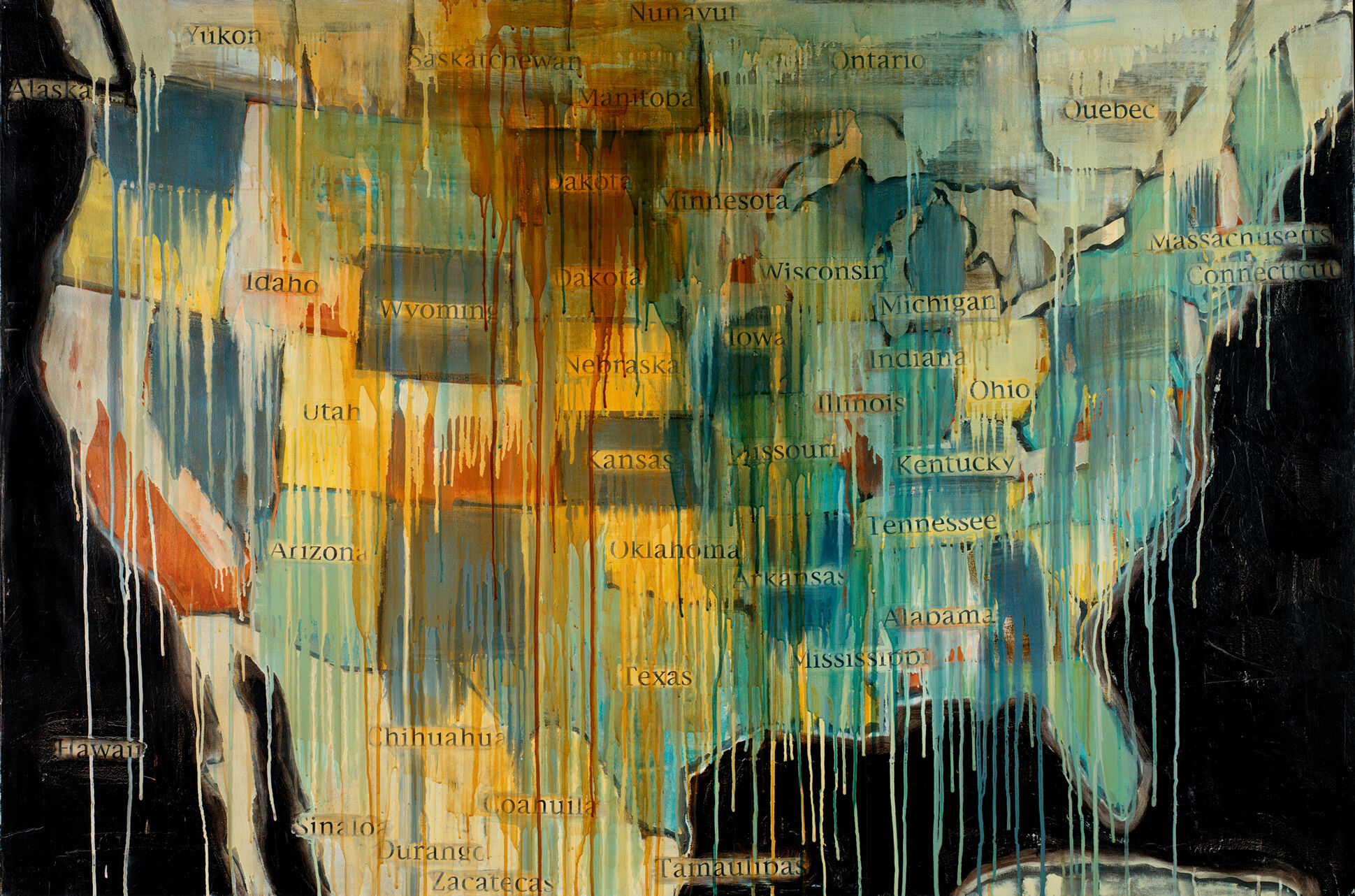
Jaune Quick-to-See Smith, State Names Map I, 2000. Oil, acrylic, and paper on canvas, 48 × 72 in. (121.9 × 182.9 cm). Smithsonian American Art Museum, Washington, DC; gift of Elizabeth Ann Dugan and museum purchase. © Jaune Quick-to-See Smith. Photograph courtesy the artist and Garth Greenan Gallery, New York
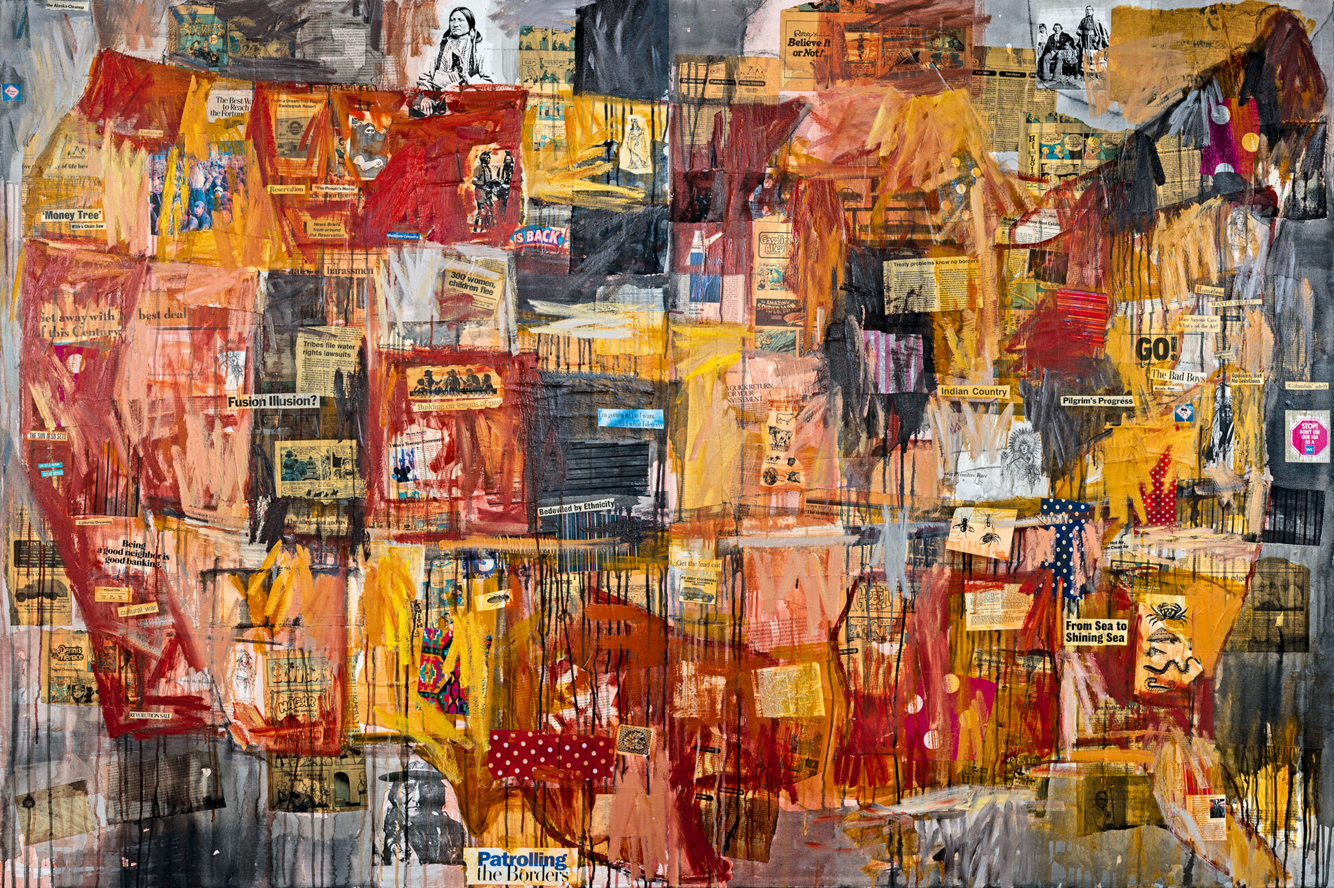
Jaune Quick-to-See Smith, Indian Map, 1992. Oil, paper, newspaper, and fabric on canvas, two panels: 64 × 96 in. (162.6 × 243.8 cm) overall. Private collection. © Jaune Quick-to-See Smith. Photograph by David Bowers
Activity
“These are my stories, every picture, every drawing is telling a memory map.”
–Jaune Quick-to-See Smith
How could you reimagine a familiar landscape?
Maps are usually symbolic representations of a particular area such as a city, country, or continent. They highlight the dominant features of the region as they would appear from a bird’s eye view. Jaune Quick-to-See Smith’s map artworks reveal important Native American histories and current events not readily visible in existing topographic landscapes or cartographic images. As the artist reflects, “Indian people consider all of the Americas stolen land. I use maps as a point of departure for the political treatment of Native peoples.”
Ask students to consider a familiar area of their neighborhood, town or city that has or is undergoing perceptible or perhaps less known or seen changes. Have them think about how they could “map out” these shifts in the landscape and make them understood by others who are from the area or elsewhere. Encourage them to carefully consider what materials would best suit their communication needs. Look at the resulting maps together and encourage students to discuss and reflect on how their artworks encourage people to see their communities in new ways.